Harnessing Explorer.land: Mapping Nature-Based Projects 🌍
The app empowers environmental organizations, investors, scientists, and corporations by offering map-based solutions that enhance transparency, engagement, and storytelling through satellite imagery and scientific data. 🌳
🌳 Unveiling the Power of Explorer.land
Visual storytelling is a powerful tool for communicating tree-planting initiatives and expanding their reach to broader audiences. Traditional data presentations, such as spreadsheets, while informative, often fail to engage stakeholders. By contrast, geo-referenced maps offer an exciting and informative way to present environmental data.
Why it matters: Engaging visual content helps both professionals and the public better understand and connect with conservation efforts. Explorer.land, developed by OpenForests, provides a compelling solution to this issue by offering a platform that merges mapping technology with environmental data, transforming how global environmental, social, and governance (ESG) projects are showcased. 🌍
🔍 Advocacy for Transparency in Environmental Projects
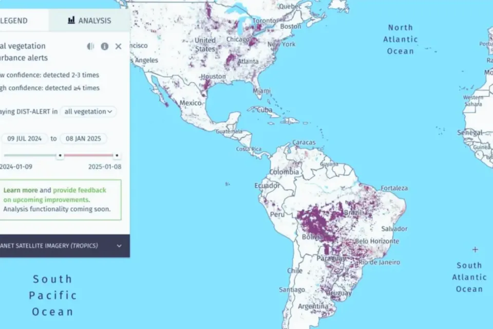
Transparency is critical in the pursuit of environmental sustainability, and Explorer.land helps drive this forward. By allowing stakeholders to visualize, monitor, and track the progress of nature-based projects, it increases accountability and engagement. Visual proof of advancements, such as satellite imagery of reforestation efforts, makes it easier for project managers to report back to sponsors and investors with clarity and confidence.
Key takeaway: By enabling transparency, platforms like Explorer.land can enhance public trust and attract investment in environmental initiatives. This transparency fosters accountability and connects quality conservation projects with potential funding sources, making it easier for sponsors to back projects that align with their values and goals. 🌱
🌐 The Current Landscape of Environmental Mapping
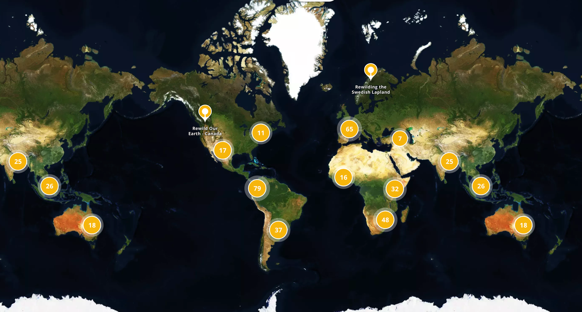
Explorer.land offers detailed, map-based presentations of projects that are globally accessible, allowing people to visualize specific geographical locations and project details in real time. This level of accessibility not only broadens the audience but also provides potential sponsors with a deeper understanding of the projects they might support. It’s a step forward in making environmental data more engaging and actionable.
Why it’s innovative: The platform allows users to view polygons on a map that represent active conservation projects, offering details about sponsors and project goals. Additionally, Explorer.land maintains an inventory of potential investors and stakeholders grouped by region, which helps facilitate collaboration and project funding. 📊
🚀 Propelling Forward with Informed Action
Explorer.land sets a new standard for transparency and engagement in the environmental sector. By providing easily accessible, map-based project data, it boosts the credibility of environmental initiatives and promotes stakeholder involvement through informed decision-making. This kind of disclosure is essential for building trust in the outcomes of conservation efforts.
Key insight: The detailed level of reporting and transparency that Explorer.land offers should inspire other organizations in the sector to follow suit. Increased public access to project data, especially when visualized in an engaging way, can contribute to wider adoption of sustainable practices and improve public confidence in reforestation and conservation initiatives. 🌍
🔓 Open Data & Code: Empowering Collaboration
Explorer.land’s commitment to transparency through open data and mapping empowers collaboration across sectors. By making project data freely accessible, the platform supports informed decision-making and encourages greater participation in global conservation efforts. This open approach aligns with broader goals to promote transparency and collaboration in environmental projects. 🌐
Curious to explore more? Visit Explorer.land to see how this platform is transforming environmental mapping and contributing to a more transparent and engaged conservation landscape.