Bridging the Gap in Carbon Verification: GEO-TREES✅🌍
In collaboration with global space agencies and leveraging over 40 years of experience from the ForestGEO network, GEO-TREES is set to make a significant impact on how we measure and verify forest carbon stocks. 🌳

🌱 Understanding the GEO-TREES Initiative
Tropical forests around the globe are under increasing pressure from fires and unauthorized logging. As more for-profit entities participate in reforestation efforts, aiming to profit from carbon credits, there’s growing concern about accurately measuring the actual carbon reduction effects of tree planting.
Why it matters: The GEO-TREES initiative, with $12 million in funding from the Bezos Earth Fund, seeks to enhance research and technological capacity in these crucial ecosystems. In collaboration with global space agencies and leveraging over 40 years of experience from the ForestGEO network, GEO-TREES is set to make a significant impact on how we measure and verify forest carbon stocks. 🌳
🔍 Transparency and Trust in Forest Carbon Estimates
Accurate measurement of forest carbon stocks and fluxes is essential for several reasons:
- Carbon sequestration: Forests act as significant carbon sinks, absorbing CO2 from the atmosphere and storing it in biomass. This makes accurate measurements crucial for tracking progress toward climate goals and implementing effective mitigation strategies. 🌲
- Carbon markets: The growing carbon market relies on precise data to trade carbon credits, supporting the integrity of these markets and helping fund conservation efforts.
- Policy guidance: Governments and organizations use data on forest carbon stocks to inform policies related to forestry, conservation, and land use, guiding sustainable management practices.
Key takeaway: Accurate measurement of forest carbon stocks and fluxes plays a vital role in sustainable environmental management. 🌍
How do you think improved carbon verification can influence global climate goals?
🌍 The Current Landscape: A Global Standard in Carbon Verification
The diversity of forest types, particularly in the tropics, presents a significant challenge due to varying ecosystems, levels of degradation, and complex biomass distribution. Tropical forests alone encompass a vast range of environments, from pristine rainforests to areas impacted by logging and agriculture.
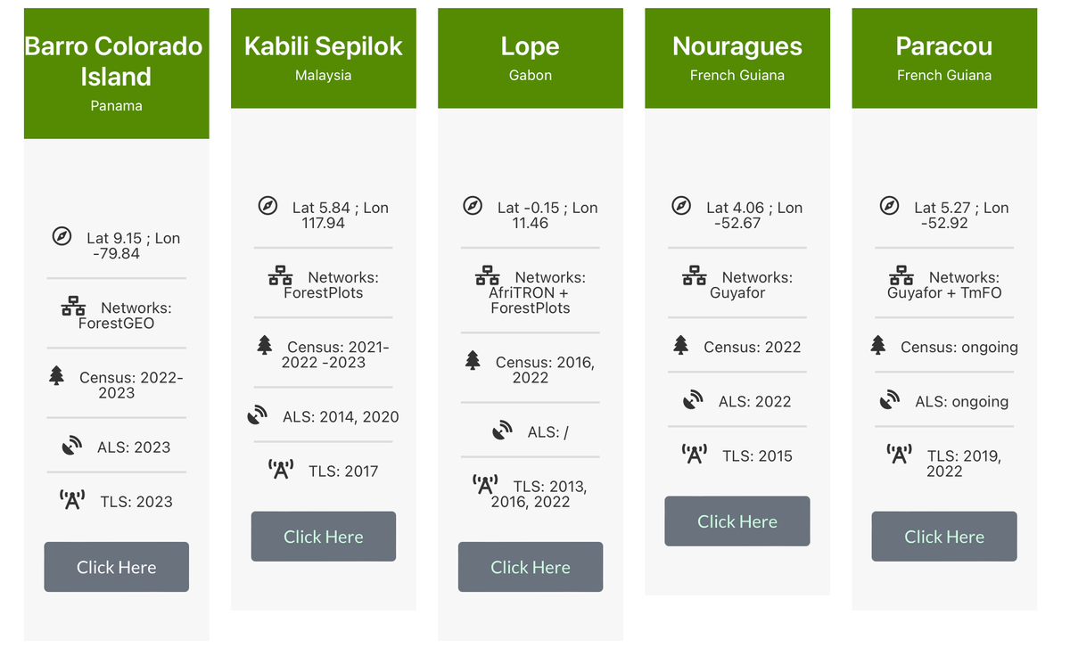
GEO-TREES’ solution: By establishing over 100 study sites in tropical and temperate forests worldwide, GEO-TREES aims to create a comprehensive database to calibrate and validate satellite-based observations. This initiative will ensure accurate mapping of forest biomass across different ecosystems. 🌱
Why it’s important: These study sites will cover various forest types, including mature, degraded, and secondary forests, and will support in-country partners and local communities, especially in regions most affected by climate change.
What other initiatives could benefit from the standardized data GEO-TREES aims to provide?
🚀 Actionable Steps: Addressing Forest Carbon Storage with Data
To assess the carbon storage capacity of these forests, scientists will manually measure trees in research plots and use terrestrial and airborne laser-scanning devices. This approach builds on decades of work, starting with a 50-hectare plot on Barro Colorado Island in Panama and expanding to ForestGEO's 76 research sites across 29 countries. 📊
How it works: The data collected from these sites will contribute to a standardized, open-access database, empowering researchers, policymakers, and environmentalists worldwide to make informed decisions on forest conservation, carbon markets, and climate change mitigation.
🔓 Open Data & Code: Promoting Collaboration
Access the freely-available data for GEO-TREES (login required to download). This transparency invites collaboration and continuous improvement in forest carbon verification. 🌐
Curious to explore the data? Dive into the GEO-TREES resources and see how you can contribute to this global effort.


