How Rethinking ‘What Is a Forest’ Can Result in More Effective Conservation
When the policy community asks, “is deforestation going up or down?” an acceptable answer can no longer be, “it depends."
This article by By Viviana Zalles, Nancy Harris, Fred Stolle and Matthew C. Hansen originally appeared on the World Resources Institute website.
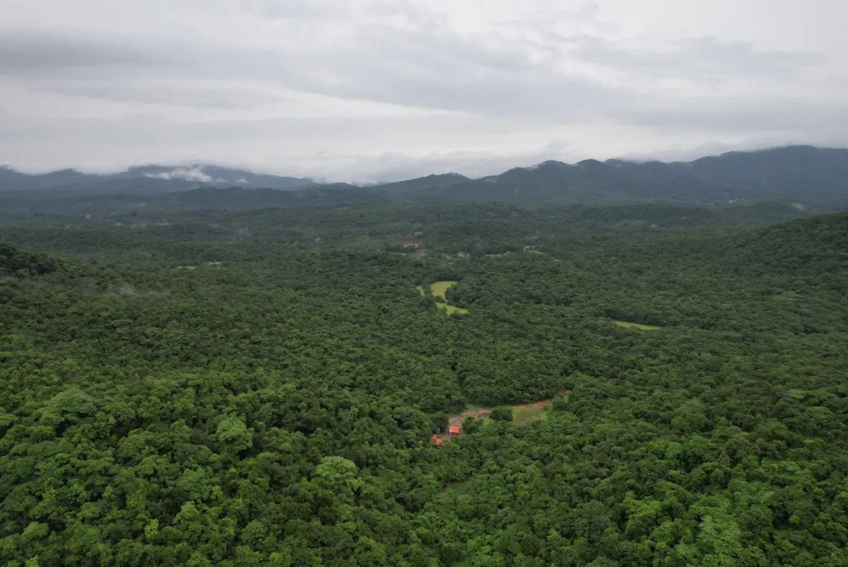
Although intuitively it may seem obvious what a forest is, there are actually hundreds of definitions used by different countries and organizations throughout the world. This can have major implications for how forests — and more importantly, changes to forests — are measured.
Without a common and standardized way to define “what is a forest?” it is impossible to consistently track global deforestation. Many countries now use satellite data for this tracking because it provides more timely, accurate and efficient information. But most existing forest definitions do not align with what satellites can actually measure. This makes it challenging for countries and organizations to use satellite data to comply with deforestation regulations or participate in carbon markets.
Monitoring forests and deforestation with satellite data is critical to accurately and consistently implementing and evaluating the success of forest conservation policies, but to do so we must rethink how forests and deforestation are defined.

3 Issues That Limit Existing Forest Definitions
A few key issues limit the ability of countries, organizations and others to monitor forest change and consistently track global deforestation:
1) Inconsistent Definitions Lead to Inconsistent Deforestation Estimates
The first issue with existing forest definitions is that there are too many of them. Nearly three decades ago, the Food and Agriculture Organization of the United Nations (FAO) defined forests as having a minimum of 0.5-hectare area (a hectare is equivalent to 10,000 square meters or about 2.5 acres), 10% canopy cover and 5-meter (16.4-feet) tree height. Countries were encouraged to adopt this definition, but FAO pushed for “harmonization, not standardization.” As a result, definitions can vary widely across organizations and countries and can even vary within a single country.
For example, Indonesia’s definition includes a minimum area threshold of 6.25 hectares while Côte D’Ivoire in West Africa uses 0.1 hectares, so all else being equal, an area in Indonesia must be at least 62.5 times as large as an area in Côte d’Ivoire to qualify as forest. Brazil’s official forest definition has a minimum area of 0.5 hectares, but an area doesn’t count as deforestation in their National Forest Reference Emission Level submission to the UN’s Framework Convention on Climate Change until it reaches twice that, or 1 hectare.
Land use is another complication. Many countries, like Canada, include timber and rubber plantations as forests, so replacing clearcut trees in natural ecosystems with a commercial plantation is not defined as deforestation because the land remains a working forest. Areas with trees considered agricultural crops, like almonds and apples, are generally not counted as forests, but areas with trees growing alongside row crops may be, like cocoa agroforestry systems.
These inconsistencies greatly affect what counts as forest and deforestation in different corners of the world. Unlike currency, there’s no international exchange rate to convert forest area reported by one country into an equivalent area using another country’s definition. The result is a smorgasbord of different forest and deforestation estimates that aren’t comparable to each other or to a globally consistent measure like satellite data, because they depend on who’s doing the counting and which rulebook is being followed.

2) Prioritizing Measuring Forests Over Deforestation
What if all countries applied the same forest definition? Problem solved? Not quite.
Even if FAO’s definition were applied across all countries, the thresholds chosen for area, canopy cover and height have important tradeoffs that matter for forest conservation. Under FAO’s definition, sparsely-treed areas, like savannas, could be considered forests. This has allowed for these ecosystems, which are home to iconic wildlife, help prevent desertification and support local communities, to be included in forest conservation frameworks.
But the flip side of applying an overly inclusive forest definition is that it may obscure the loss of high priority tall forests with dense tree canopies. These forests store the most carbon, harbor the greatest biodiversity and play the most crucial role in global climate regulation.
For example, a 0.5-hectare patch of dense forest could lose up to 90% of its tree cover and still be counted as a forest, since it would continue to exceed FAO’s minimum 10% canopy cover threshold. This wouldn’t be much of an issue if most deforestation occurred at a larger scale. But in many places throughout the world, deforestation occurs at small scales that fall within this 0.5-hectare minimum threshold.

For example, in the Democratic Republic of Congo, where subsistence agriculture — or the practice where people clear small patches of forest to grow food primarily to meet their own needs — is common, satellite data reveals that over 20% of the country’s 2023 primary forest loss occurred in patches smaller than 0.5 hectares. This is a significant area: The country had the second highest annual rate of primary forest loss in the world over the past two decades.
Those small patches of forest loss add up and risk being omitted from the global deforestation record when definitions prioritize the measurement of forest area over deforestation.
3) Lack of Alignment with Satellite Data
The third issue with many forest definitions is that they’re a relic from a time before satellites, when foresters went out on foot to measure forest attributes like how much timber could be sold and tree species in permanent inventory plots.
Forest inventories created through fieldwork remain essential in providing today’s forest managers with vital information that satellites can’t about how forests’ many ecological, economic and social functions are changing. Yet when it comes to monitoring deforestation — the loss of forest area — scientists have shown that it can be tracked with higher accuracy and lower costs than ever before using satellite data. Crucially, this data is free and openly accessible through platforms like Global Forest Watch.
But the definitions originally designed to monitor forests on the ground just don’t work with data collected from satellites. One reason is that satellites commonly used for operational forest monitoring capture information in different sizes that don’t perfectly align with the 0.5-hectare minimum size commonly used in many forest definitions. Further, by using a 0.5-hectare minimum size for forest mapping, the level of detail in the satellite data is reduced, effectively "blurring" the finer information. Forcing a 0.5-hectare minimum forest area threshold onto a satellite image can result in forest and deforestation measurements that are 5 to 50 times less precise than if the satellites’ original pixel size was retained.

How Do Definitions Impact Policy?
The inconsistencies in forest definitions for countries and organizations using satellite data create challenges when complying with conservation efforts that require the reporting of deforestation across many sites and countries.
For example, companies trading in products that fall under the European Union’s Deforestation Regulation (EUDR) may need to comply with the EU’s laws following one forest definition and with national environmental laws following a different definition.
Further, even though the regulation requires that companies provide geotagged evidence that certain commodities were not produced on deforested or degraded land after 2020, in reality this is difficult and inefficient to prove with satellite data because the EUDR’s forest definition isn’t designed to work with satellite data.
Another example is carbon credits, which are designed to reduce carbon emissions from deforestation.
For a carbon market to function, carbon credits must be fungible, or mutually interchangeable, such that an emission reduction credit can be used to offset an emission elsewhere. But when both the area of forests and the amount of deforestation are measured differently across different locations, the quantity of credits generated by reducing emissions from deforestation may vary depending on where they originate, potentially eroding buyers’ trust in the system. It therefore becomes impossible to evaluate consistently across jurisdictions or against global data sets whether deforestation has declined.
Toward Consistent Measurements of Forests and Deforestation
Philosophical debates about “what is a forest?” will always endure, but the urgency to conserve forests and cut carbon emissions has never been greater. Timely, accurate and efficient monitoring is key to evaluating the success of forest conservation and emissions reductions policies.
We need a pragmatic approach to deforestation monitoring that balances the ecological value of forests with technical monitoring requirements. Internationally coordinated conservation action requires internationally coordinated monitoring systems. Though absolute consistency is not necessarily the goal, nor would it be realistic, standardizing key elements of forest definitions would go a long way to achieving this:
- Definitions of forest extent and change should have standardized minimum area thresholds that align with public satellite data capabilities (10 to 30 meters or 33 to 98 feet)
- Forest definitions should distinguish between natural forests and other types of tree cover, thereby excluding plantations of wood or other agricultural products.
Reducing the minimum area threshold in forest definitions doesn’t mean that every pixel with trees will be considered a forest. Pixels can be assigned to different categories to differentiate between types of tree cover — such as trees in primary forests versus secondary forests, or trees in dense forests versus areas with sparse trees — and use that information to determine what counts as a forest in different contexts.
Likewise, not every pixel with tree loss counts as deforestation. For example, trees lost to natural disturbances like storms or landslides aren’t considered deforestation.
All these distinctions can be made either by using maps that show additional contextual information, or using sampling methodologies, where analysts can carefully look at individual pixels to determine which category they belong to.
It is time to rethink forest definitions so that forests and deforestation are quantified consistently and reliably enough to evaluate whether global forest conservation outcomes have been achieved. When the policy community asks, “is deforestation going up or down?” an acceptable answer can no longer be, “it depends."
License
Zalles, V., Harris, N., Stolle, F., & Hansen, M. C. (2024, November 11). How rethinking ‘what is a forest’ can result in more effective conservation. World Resources Institute. Retrieved under a Creative Commons Attribution 4.0 License with minor changes to original image and format.
